Nov 30, 2013

Peck’s Corner Shelter to Newfound Gap

Up early this morning, struggling outa cosy sleeping bags at 7 to try and make it onto the trail by 8:30. We'd arranged to meet Tom at Newfound Gap at 4 pm so wanted to get in a little early if possible. Anthony was up up and away early, cold brekkie of pop tarts, didn't sound so pleasant.

It was hot coffee, biscotti, and hot oatmeal for us, trying out the "re-usable" backpackers pantry foil pouch to cook our oatmeal, an experiment for the first time and it worked well.

Temps musta been just on the wrong side of freezing, matildas bladder had some ice in it and we had a lotta fun trying to get some water out of it, ended up having to tip out some ice because the water wouldn't run through the pipe. Then once we got hot water, we saw mouse droppings in Matildas cup, yuuuk, rinse rinse with hot water to clean. And then we noticed that they decide to use our totally unique ultra-light pot holder for nesting material, it was just all tore up.

The colder night meant another drawback for the am, frozen socks and shoes. The night before, the fire kept us a little warmer and dried out socks and shoes, these babies were solid and getting shoes on over blistered heals was as painful as it sounds, or worse. I decided to keep on dry overnight socks since they wouldn't be needed for the next night, wise decision.

A long way on the trail with no markings or bearings to tell you how far you've gone, we made the best time we could but hard to tell, around 11:30 we came to an intersection with the Dry Sluice Gap trail, 6 miles from the shelter and only 4.4 from Newfound Gap, well ahead of schedule. It's only .4 to Charlies Bunion,

so great place for lunch and we're starving, 2 hours on the trail is a lot on some oatmeal. Plus Charlies Bunion is rumored to have one of the best views in the park.

It does indeed! It's a rough rocky outcrop at the end of a short side trail, right in the sun, no wind at all, so lovely and warm under that strong southern sun, this ain't no wimpy New England sun here, this baby shines and warms things up quite nicely in the cold weather, thank you very much.

Charlies Bunion was supposedly created when the North American and African plates came together for an orgy around 400 million years, I kid you not, that's how wikipedia described it.

The etymology of the Bunion is rather sad and tied up with the general destruction of the great woodlands of the east coast of the US. The lower elevations were heavily logged during the 19th century, leaving large piles of dry timber scattered around. In 1925 a massive fire started in the dry dead timber and raced up towards the higher elevations. The heat was so intense it burnt everything in it's path, and also destroyed the soil, making it infertile. As luck would have it, a massive downpour 2 years later washed away all the dry, dead soil, leaving the Bunion exposed. The soil and trees have gradually recovered, but still for sure don't have their original majesty, thanks to the greed of the timber companies and indifference of the authorities.

The Bunion was named after Charlie Connor, who climbed up the formation a few days after the downpour with some explorers. Apparently Charlie had a bunion on his foot that was so large it could have had a place on a map. Instead the place on the map got it's name from the lump on Charlies foot when one of the explorers who saw it remarked "Well that sticks out like Charlie's bunion". Southern explorers apparently hadn't yet discovered the reference to male canine anatomy.

We lingered for a while here, plenty of time, and plenty to stop and chat with some day hikers, one of whom had just completed the AT after 17 years of trying. We go up and up for a bit, icy and hard to walk without slipping, a stop at icewater spring to refill a bit, it's easy because right on the trail.

The icy trail prompts a decision to try out new micro-spikes, it hasn't been that icy so far, a lotta snow on the trail, but here we're on a very popular day hike part of the AT and the treadway is packed down from the ceaseless tramp of feet and has frozen overnight into ice, so walking is difficult.

It's a revelation, and freedom for walking, the spikes dig in and you don't have to worry about footing, I was worried how they would be on rocks, the spikes dig in pretty well in fact. We blow past normally shod day hikers on the way down like they were standing still, they just get outa our way, and we're trying to take it easy so we don't have to stand around in the cold waiting for Tom at Newfound Gap.

We're so far ahead of schedule that we take a short excursion on a side trail with an old bench and nice view, right in the sun. It's so warm here that the snow has almost all melted and the ground is muddy instead of icy.

We get to Newfound Gap an hour early, some folks stop to chat and ask questions, it reminds a little of Carvers Gap where there was a small mob scene. There's a lotta traffic coming and going, parking, driving around etc. It looks very touristy, people just get out and walk around a bit, snap some pictures at the TN-NC State line sign, and then leave. Only a few take off up the AT to burn off some of the Thanksgiving pounds.

There's a plaque at the gap titled "For the Permanent Enjoyment of the People" which briefly describes the dedication of the park by Franklin D. Roosevelt in 1940. Formation of the park was a struggle, since the land was occupied both by small farmers and huge lumber companies.

Activists in Knoxville, Tennessee, and Asheville, North Carolina, worked to create the park. Oddly enough the activists were mostly motorists who wanted a nice road through the park that would accommodate their shiny new cars.

The federal government was not allowed to buy land for the park, so the states provided some of the money, and local fundraising provided the rest. Unfortunately by the time the money was raised, the price of the land had doubled, and the effort looked like it would founder.

Along came the Laura Spelman Rockefeller Memorial Fund, founded by her husband, John D. Rockefeller. If you know the history of the Standard Oil Company, this might seem rather odd, since it was and still is a major destroyer of the planet and contributor to global warming, under its current incarnation, Exxon Mobil.

However Standard Oil had become so despised by the early 20th Century that Rockefeller turned to Philanthropy to buy himself and his company some goodwill, hence the formation of the fund and the contribution to the park.

Tom arrives early and we chat and take some more pix, he gets us by the AT sign and the state line, with me on the NC side and Matilda on the TN side. There's a line of people waiting to do the same thing, but they're all clean and well dressed.

It's quite a ways back to our parking area, the Newport Walmart. Tom knows the area well and misses the Gatlinburg madness, thank goodness. The car is safe and sound, always a little worry when using public parking areas for a length of time.

Now where off to the American-Russian diner (Grill 73) for apres hike meal one, it's warm and cozy inside with a real fire going, but empty, can't help wondering if these guys will make it, maybe just the post-thanksgiving eating out blues have struck and everyone stays home.

It's run by Valentina and Alex Ryzhkov, they have both Russian and American dishes, but of course we wanted Russian food so got Borsch, Cabbage Rolls and a variety of pirozhki, small pastries that are stuffed and then fried. The cabbage rolls are amazing, they melt in your mouth.

We'd love to linger by the fire, but they have no alcohol licence, and we have an appointment. Alex sheepishly explains that it's because of the Church next door, hard to imagine Russians being puritanical about alcohol where, until recently, beer was considered and regulated like food.

Down the road to Hot Springs, we have plenty of time to get there, so we think, we have an appointment to luxuriate in a hot tub at 7 and its just past 6. But wait, there's a catch, a bridge is down and there's a detour. It was down last year too, but local knowledge got us around it.

Now we haven't a clue where to go except to follow the detour and hope it's not too long. The GPS is now useless, it keeps giving us the tired old "make a U-Turn in 300 yards" message. We drive and drive, up into the mountains and miles from Hot Springs, the GPS arrival time goes from 6:45 to 7 to 7:10 and 7:20, and finally the GPS gives up trying to U-turn us and it looks like 25 minutes late, Matilda gets very frustrated and starts beating up the steering wheel.

I try to call the spa but the signal is very weak and the phone is almost dead, the call drops out and I put the phone on the charger and finally get through, but we're almost there now. The only thing they can do is give us a 50% refund, and shorten the time, they're totally booked so we can't get another time.

We're not sure what the set up is, I had imagined a big building with baths like Berkely Springs in West Virginia. In fact they have little shelter like structures which are fairly open, and a regular hot tub underneath. I start wondering what it's gonna be like to get out, it might feel very cold before you dry off and get some clothes on, and in fact it does. It does really feel good in the hot water for weary muscles and bones, alas it's all too short.

We're kinda wired after all the stress of getting there, so it's time for copious pints of beer all other imbibes to help us sleep, no more driving needed. First stop is the Iron Horse Inn for dinner #2, a black bean burger with sweet potato fries and a local IPA.

There's a cupla young folksy musicians playing up front and they strike up "The House of the Rising Sun" as we get set to leave, so we sit right in front at a vacated table to hear it through, and start wondering how old it is and who wrote it, I know if from the 70's in Oz.

It turns out to be a bit older than that, the origins are obscure and seem to date back to an 18th century English folk ballad called "The Unfortunate Rake", about a young man dying of syphilis, writers and folk musicians have evolved it into a large number of variants, including the "Streets of Laredo". The common theme is young people cut their down in their prime and contemplating an untimely death. I'm pretty sure the version I know is the one by Eric Burdon and the Animals.

Dave Von Ronk, a 60's folk musician, made a creative arrangement of the rising sun version using some jazz influences. He taught it to Bob Dylan, who promptly recorded it for his debut album, to the chagrin of Von Ronk, who was intending to record it.

We ain't had enough to drink yet, round 2 coming up across the street, it's much more lively and local, we chat with a guy who's working on $600,000 cabin out in the woods somewhere, apparently they camp out in the place during the week, and come back to town on the weekends, sounds like outback Australia to me. It's a bit hard to talk because the Blue Grass is thumping away, all 6 of 'em playin up a storm.

There's another guy who looks like he be a thru-hiker, thin as a rake and scruffy, turns out he's the Master Carpenter for the project, almost cut his finger off with a power saw. The pix of the place look amazing and we wonder if we can get him to come to Flagstaff and build us a cabin in the woods.

The place only has beer and wine, no hard liquor, I'm about done with IPA so switch to Guinness for a change while the band plays on. They end too soon though and we yell for an encore, we get one more song and that's it. Meanwhile the cabin dudes have bought a pitcher of Guinness and keep filling my glass up, so now I'm good and toasted and will get a lovely sleep. Luckily our room is in the same building, we can stagger out the door and walk 3 feet.

Nov 29, 2013

Nov 29th, Cosby Knob Shelter to Peck’s Corner Shelter

This was our longest mileage day, and we didn't particularly get an early start. The good news was we had a nice hot brekkie of Backpackers Pantry Blueberry Granola/Oatmeal. Our gear frenzy for the trip included a new stove, a Primus that had a heat exchanger and a wind screen and held out the promise of faster boiling water in the cold conditions. I think these kinda stoves are the future of backpacking (if not of ultra-light backpacking) because of their fast heating and wind mitigating properties.

It did indeed! These shelters in the smokies include a wind screen though, a piece of tarp across the front to keep the

wind and snow out, so we never had need of the windscreen. The water does boil quickly, and we had steaming instant coffee in a cupla minutes, with some small biscotti as an appetizer while the second batch of water was heating up for the oatmeal.

As I was drinking my coffee and waiting for the boiling water, I noticed an ache in my forehead, above the right eye. It wasn't too bad at first, probably from dehydration, but would get worse as the day wore on.

Matildas shoes and socks were dry the night before, mine had been a little wet, can't tell if it's from sweat or leaky shoes, anyway the fire has dried my socks overnight on a warmed up rock, and the temp is above freezing, so no worries getting shoes on, even over blistery feet.

A bit of a climb outa the shelter, up and over 6000', a rarety on the AT indeed. It was sunny and snowy again, really lovely views and sparkling light off the snow. It's mostly dry, but with some wet patches to test our boots, mine look

we on the outside We got out before Afternoon Delight, he didn't look in any hurry, and were expecting him to pass all morning, I get expecting to hear foot crunching in the snow, he never showed up though until lunch.

We'd been a bit lax with a food the night before, too cold for bears we thought, now we're seeing what look like paw prints in the snow, the follow the AT for quite a while, then disappear somewhere, than even later we can see where the bear walked down outa the woods and onto the trail again, a bit of a worry if they're still around, supposed to be hibernating.

I'm not having a good day, my heals hurt from blisters and my head is pounding from a headache. I try to drink as much water as possible, hoping it's just de-hydration, it doesn't seem to help much. The uphills are hard on my blisters, the snow seems to be the culprit, I've winter hiked in these boots before without a problem. The snow seems to push feet back into the rear of the boot and then twist a bit, so it feels like sandpaper is in my socks, ouch.

We see a sign for My Guyot, one of the highest peaks in the mountains at over 6400', it's been quite while since brekkie and I'm getting very hungry, not sure what the sign means since the AT doesn't go over the mountain peak (are you reading this AMC??), however there is supposed to be a side trail, might be a good place to stop for lunch.

Alas Mt Guyot or a side trail never come and we end up at the next shelter, Tri-Corner knob. It's nice cause the water and privy are close, and it has a bit of a view of the lower elevations. As we eat away, Afternoon Delight arrives, eats fairly quickly and then hussles off, think he's trying to make either the Gap or Icewater Spring for the night, and bypass our destination, Pecks Corner.

During the afternoon we meet some hikers who started from Newfound Gap yesterday, the news is that the gap road didn't open till 2pm, a good thing we didn't wait, it'd been a very late start and arrival to a shelter, and we'd a hadda reconfigure the whole hike and try to make up the lost distance.

They slept at Icewater Spring last night after a short in-hike, and said it was very crowded, full in fact, I started to think that maybe all this big herd of hikers was headed for Pecks Corner and hadn't bothered to register or check the online reservation status, we'll see.

Pecks Corner is a ways off the AT, never a favorite thing to experience at the end of a long day on the trail. It's downhill as well, which means another climb in the morning. My head is still pounding as we roll in, there's only one other backpacker there and he reports that the rangers had told him only 3 at the shelter tonight, good news.

I resolve to get water immediately to try and suppress my headache, think we didn't have enough the night before. Anthony, the other backpacker, reports that the water source is back on the link trail, I walk back up and don't see any water, getting frustrated with this shelter already.

David Miller's guide reports the spring as being just South of the shelter side trail, but can't find it. I go back to the shelter to find out what the companion says, I used up most of my phone battery the night before reading a John Grisham book on the Kindle app, so gotta fire it up to check the companion.

It reports the spring as being 50 yards in front of the shelter, and Matilda has gone down to the horse hitching post (yes they allow horses and pack animals in this park), there's a sign with it's back to shelter that points to the spring in front of the shelter, really guys this shelter is just a nuisance.

I fill all our water bottles so we don't have to come back, the trail down to the spring is very steep and slippery, if short, don't wanna have to come back again. We have plenty for dinner and brekkie, and to get us a good way down the trail on the morrow.

Our companion Anthony tries to make a fire, it's fairly big chunks of wood and it's a no-go, the list of issues with the shelter grows, there's very little wood around as well so it'll be a colder night, and it's almost dark. Then matilda notices a mouse high up in the beams, oh brother this just gets worse.

It also means we gotta hoist our food on the bear cables, mice are actually more of a menace. We heat up some water for tea and a snack before Pad Thai for dinner and retire early. Even sleeping pills don't help and I lie awake for quite awhile, cell phone battery is too dead for reading and I remember Bakers comment about the one thing he wished he hadda bought on the trail, another extra battery for his phone.

Nov 28, 2013

Nov 28th-Davenport Gap to Cosby Knob Shelter

It's a Hampton brekkie for us, nothing else open this early anyway in Cherokee, and you can make it hiker size, plus we supplement with biscotti and granola. It's about 45 minutes up the mountain to meet Tom and get shuttled back to the hike start at Davenport Gap, so we leave at 7:15, it's in the low 20's, very cold and the windscreen is covered with ice. As we drive towards the park, the temps drop below 20 in places.

We see a flashing sign, Road Closed ahead, we press on anyway to check it out, got nothing else to do. Damn, the road is closed, they haven't cleared the ice yet, Tom assured us they were quick to do that.

There's a another car stopped in front of us, and a snow plow at the barrier, so someone from the other car gets out to chat and I follow. The driver says the road maybe open by noon, that will put us seriously behind schedule, and we don't know if Tom can get into the park from Gatlinburg, or if we can get in touch.

Another car has pulled up as well, and Matilda is chatting with the guy, as I approach he says "Malcolm", it's Tom, he drives up from this side, so at least we can discuss options.

Tom suggests we do the hike in reverse, drive over to Davenport Gap, leave the car there, then shuttle back to Newfound Gap, where we planned to finish, and start Northbound on the AT. That assumes the road will be open by the time we get back.

I can't think of a better plan, so off we go, we try to think of other options and it occurs to me that we could just leave the car at Davenport Gap and start from there, and have Tom pick us up from the Newfound Gap on Saturday. It's an extra expense but will keep us on schedule.

We discuss with Tom once we get off I-40 at the Pigeon River exit, and he can do it Saturday, but the side road up to Davenport Gap is icy and Tom doesn't wanna risk it, he's a local so knows how to drive on these roads. The plan was to park at the Rangers Station just down the road from Davenport Gap, since there have been a lotta breakins at the gap itself.

We can't park under I-40 as well, it doesn't look safe, and then we notice an old Ford Bronco parked nearby with outa State plates, the back window is smashed, we look inside to see if it's been trashed or is wet, it doesn't look too bad so probably hasn't been there for too long, but definitely not a good place to park. More on the Bronco later.

Tom suggests the Walmart at Newport just up the road, our plan was to come back to Newport anyway on Saturday to eat at the American-Russian diner (Grill 73), so that sounds good, Walmarts are open 24 hours with lotsa coming and going, so no one will notice the Rav parked there.

It's time for a pitstop by now, and we have extra brekkie to eat from the Hampton, a gas station will do nicely, get some extra hot coffee to wash it all down with.

We're ready to go at 10:15, very close to schedule, gotta do an extra mile and a half or so on the trail to get to Davenport Gap but no worries, it's a beautiful sunny morning, cold but windless, Tom snaps a cupla pix as we hike off into the woods.

Davenport Gap doesn't seem too far, we stop there for a bit because it's where the AT clock 
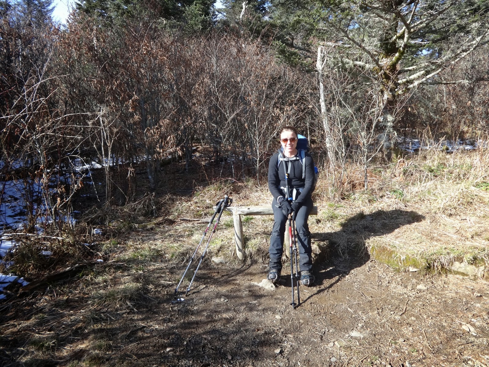
starts again for us, new trail miles, nice. A cupla pics to set the stage, I try a 10 second timer shot from my camera, it seems to work but will turn out blurry later.

By now I can feel a little heat in my left heal, and then the right one kicks in too, so decide to stop at Davenport Gap shelter to put some moleskin on them, not a good sign so early in.

I'm still a bit cold, my hands particularly are usually the last thing to warm up, so try to do it quickly, also don't want cold feet, the moleskin goes on without the usual covering of Leukotape, not a good idea. The moleskin is going on damp feet and doesn't last long, my heels will rub and hurt for the whole three days.

We stop at the Mt Cammerer side trail for lunch, it's turkey of course on this day but it's a thick slice and very dry and gives me some start of indigestion. Not so keen now on the fire tower but Matilda wants to go so take off pack and slack down the .6 to the tower.

The tower is enclosed and has windows, so nice and warm from the radiant heat, there are 3 backpackers inside chillin, one looks a bit tired and is lightly dressed, I ask if he a thru-hiker cause he kinda looks like one, young, a bit grubby with a long beard, he says yes but their story doesn't make sense, they seem to be going North, when I ask what direction they're going they say East, turns out they're just doing a short 2 day trip.

They look settled for the night, too tired to go anyway else, it's not an "official" camping spot but will do, no rangers around this far into the woods. It's a bit hard to leave 'cause it's nice and cosy with the strong Southern sun streaming through the windows and warming things up, but we drag ourselves away eventually after snapping some pix of the views, and head back to the AT.

Since I don't have a pack on, I try to run a little on the trail, it's snowy but runnable for the most part, not too steep up and down, get back to the AT early enough for a pit stop before Matilda arrives.

Only 2.8 to the shelter now, and it appears to be downhill all the way, nice after lunch, uphills are a problem in the afternoon. We take a brief stop just shy of Low Gap to put hat and gloves on, it's getting a bit later and even the Southern sun is getting low in the sky and losing some intensity.

Something catches my eye, I turn back up the trail and see another backpacker coming down, it's a South bound (SOBO) thru-hiker headed to the same shelter, nice to have company for the night, and he wants to get a fire going.

The AT companion has tricked us again, there's an uphill to the shelter, it's not too long but feels hard with chewed up heels at the end of the day. SOBO (Harrison or Afternoon Delight) is there of course, a little firewood in shelter, which has an internal fireplace, if we can get it going it will definitely warm up the place.

Alas not much wood around, we search and search and come up empty, climb up a steep embankment behind the shelter winching in pain from sore heels and it looks like the effort was wasted, but finally find a rhodie with a lotta dead branches to break off, they're nice a dry and snap right off. It's not much but there are some logs in the fireplace and couple outside, we might make something of them.

The fire is going, it's only small though and we pile on some of the big logs to see if they'll light, they do somewhat and help to give off more heat, Afternoon Delight puts his soaking wet Gore Tex shoes near the heat to dry a little. There's a nice bench close by to sit on and keep warm, even a little heat helps to keep hands and body comfy.

My first task once the fire is going is to look at heels, they're indeed chewed up, something about walking the snow, it pushes the heels back and grinds them into the back of the boots, I used the same shoes last year without a problem, you just never know.

The moleskin is completely gone, eaten by the socks, so more needed, plus a lotta leukotape to hold it all in place. I do a pretty good job on both feet, particularly the right, and it holds to the end, tape wrapped around and around to hold. It doesn't lessen the pain much though.

I put on my dry pair of socks and something new, a pair of booties, they're very light and comfy and am hoping warm enough in the evening to keep feet happy. I forgot about getting water though, the spring is close by but ya gotta walk through it basically to get water, not good in these shoes.

They turn out to be OK to walk in the snow, they don't get wet easily and y ou just crunch around in them to go to the privy etc, nice. I put my wet socks on a warm rock by the fire to dry and get my shoes within heat range too, nice to have dry boots in the cold morning.

Matilda has new shoes and they're a wonder, Lowa Gore Tex, totally dry feet, I can never get there because of sweat, she's in wonderland though, a very happy camper.

This will be our holiday dinner, Backpackers Pantry Red Beans and Rice spruced up with some fresh Turkey. We even have desert, Pecan tarts, that will be really yummy. We have a new cooking pot/stove combo, a Primus with a built in heat exchanger, these babies heat water fast 'cause the heat is contained by the exchanger, and it has a windshield to further contain the heat. There's no wind in this shelter, it has a tarp over the front to help keep it out so the place doesn't get too too cold.

Food always tastes so good on the trail, and it warms you up. It seems impossible to get warm in the evening without a fire, no matter how many layers you put on, without enough coal in your body to keep it warm.

The tarts go in the cooking pot by the fire to warm them up, I keep turning them around make sure they're heated through and it works nicely, great desert.

We chat a bit with Afternoon Delight and start talking about a thru-hiker we met who baked muffins on the trail and suddenly his face lights up and he says "arrggh Baker". It's indeed a small world on the trail after all, they met when Afternoon Delight was doing his flip-flop by hiking NOBO and hiked together for a cupla weeks.

We're fast running outa wood, I manage to re-arrange the big logs to keep some heat going and get closer to the fire, it's fading fast and the others crawl into their sleeping bags, it's still very early and once I get in I read on my Kindle app for a while but the battery seems to die fast in the cold and I gotta turn it off.

May 30, 2013

Franconia Notch to LIttle Haystack Mountain to Speare Memorial Hospital

An early breakfast in Littleton, maybe shoulda gone to Polly's Pancake Parlor instead of the Coffee Pot, ah the wisdom of hindsight. I hadda order to fattiest, most greasy thing on the menu, in a place I think is known for fatty and greasy food-eggs, corned beef hash, bacon, etc. I figured it would be OK since we were gonna do a quite difficult AT section for the next cupla days and I'd burn off all the fat.

Nearly all the way through and a sudden abdominal pain, maybe all that fatty food just doesn't wanna go down, which has historically been a problem for me. I still remember as a child eating a big load of "crackle", the fatty skin from a pork roast that goes crispy while baking and tastes delicious, but made me feel quite ill afterwards.

We drive to the trail head at Franconia Notch and it seems to be getting worse, and hiking up doesn't help much either, it's not an easy trail and having a pain in the belly doesn't help.

It's only 2 and a half miles up to the first water stop at Liberty Springs Campsite, it's not immediately obvious and a couple that looked like they camped there were no help, ended up getting water just off the trail and then saw the real spring just up ahead.

Belly pain is getting worse and I start to get worried for the first time, doesn't look like it's going away anytime soon and the trail is not getting much easier, ups and downs and some thick brush that overgrows, plus the inevitable rocks that have to be navigated.

We get to Little Haystack and sit to rest, the pain is by now almost unbearable and we have to decide what to do, I know abdominal pain is a serious, perhaps even life threatening problem if some internal organ is under such duress, calling 911 might be a possibility but what would they do? There maybe no signal anyway, there's no where for a chopper to land, and getting up to the ridge top with gurney (and back down again) would seem to be next to impossible. I've seen hikers rescued by a gurny but the terrain was much easier than this.

I'm at least still mobile at this point, and the Falling Water trail heads back down the mountain, it looks perilously steep however. We'v done it before, about 2 years ago as part of the Presi traverse, but that was carrying only a very light pack and being fit and healthy. This looks like an entirely different animal indeed.

It seems to best option anyway, so we head down and for a while I do OK, slow but we actually pass a cupla other backpackers, 2 guys and one is rather overweight. I haven't eaten anything for a while now and I start feeling a bit weak, although not hungry. We come to a junction that I remember from 2 years ago and sit for a minute to rest and the 2 guys pass by but don't say anything.

More slow progress down, sit again to rest and I suddenly feel nauseous and throw up, that can't be a good thing, getting weaker all the time but still able to carry the pack. Again the guys pass us and one comments that I need to drink more water, how stupid can you get, can't he see there's something seriously wrong?

There's nothing to do but keep struggling on, getting more and more difficult. It's actually quite a pretty trail, lotsa waterfalls to look at, and the water running down huge sloping rockfaces that you walk across, but I can barely appreciate it.

Another stop to rest, and another chance to barf, we still manage to pass the two guys, and they still manage to pass us by without saying anything about my obviously distressed condition, and now others are coming up the trail and don't say anything either.

I'm getting more and more zombie like, soon I'm gonna bite someone and they'll turn into a zombie too. At some point we stop to rest and Matilda grabs my pack and takes off with both, one of the front and one on the back. By now I really feel like a zombie, barely able to walk and still no one stops to help, despite my zombie like appearance and Matilda carrying 2 packs, what is it about folks here?

It seems to take an eternity to get to the bottom, ultimately about 5 hours to do about two and a half miles, we're obviously close now and the plan was to call the local shuttle folks and have them take us back to the car and go to the nearest emergency room, but I'm too far gone for that, can barely walk, so Matilda calls 911.

We come to the end, there's a nice grassy spot so I just collapse into a ball and finally someone asks if I'm OK, not likely but the ambulance is on the way, thanks anyhow. Maybe I shoulda done this earlier?

First to arrive are the police, they're not much help and the cop opines that it's my appendix, not likely since they're already gone. I'm expecting it take a while for the ambulance to arrive, it's a rather isolated spot, it comes pretty quickly in fact and they ask if I can walk, that would be yes with a little help.

They take blood in the ambulance and the tech remarks that it looks like goo it so thick, yes I'm severely dehydrated because I couldn't keep any water down, also partly explains the zombie walk.

The pain is really bad now, rate it 8 outa 10, I lie on my side in the ambulance because it eases it a little, they don't know what it is so can't give me anything for it at the moment.

At the hospital and I suddenly realize Matilda isn't there, I know it's only gonna be a few minutes since the police took her to pick up the car, but still it's an overwhelming feeling of loss, hope it's quick.

First thing is an MRI to see what's going on, I gotta drink this stuff that actually doesn't taste bad, they figure I'll throw it back up at some point but ask if I can hold it in, I manage to do so until the procedure is over and out it comes, at least it relieves the pain a bit.

The doc comes in and asks if I'm still in pain, that'd be a yes for sure, so they give me some morphine derivative, it takes a few minutes but finally comes, an extremely pleasant sensation of painlessness and relaxation, oh heaven.

The doc has diagnosis, they can see that the stuff I drank has just gone so far into my small intestine and then stopped, it's completely blocked and scar tissue from a previous operation is the culprit, it's somehow wrapped around the intestine and blocked it off, ultimately a life threatening situation since the intestine can die from the blood supply being choked off, then it bursts and you're really in big trouble.

The treatment is to jam a tube down the nasal passage and try to drain everything out with some kinda pump and see if the intestine will unblock itself, it never seems as if much comes out and the pain doesn't subside much without pain killers, so by Sunday they decide that the only course is to operate to remove the blockage.

May 29, 2013

Kinsman Pond Shelter to Franconia Notch

We woke up at 9:30, a 12 hour sleep, a new record for me I think, how tired must we have been after a long yesterday. There was a heavy fog all around, so thick you couldn't see the lake well at all, so no pictures.

The trail starts off easily, then goes straight down, took us 30 mins to go a quarter of a mile, inching down the steep rocks. It does get easier but is basically a stream bed, wet wet and more wet, with occasional steep rocks to descend.

It's only supposed to be 2.7 miles to Lonesome Lake Hut, seems to take forever. Finally there and it's only staffed by the caretaker at the moment, its cutover time to being fully staffed for the summer and the crew is arriving, we sit around drinking tea and eating some cake before heading down the last few miles to Franconia Notch.

The summer crew is like a mule train, they carry huge supplies on their backs with some awkward looking arrangements, the first mule is worried about his performance, whether he'll be able to do it, the caretaker is re-assuring.

We head off down an easy trail, there are warning signs about the bridge over Cascade Brook being out, should we Yellow Blaze and go down the alternative, or chance being able to get across the stream?

The brook is definitely raging, more and more as we go down, and no at all of the bridge when we get to the crossing point, looks like it was completely swept away.

The recommended crossing point is just upstream, we pick up a likely spot with rocks to hold onto and plunge in, boots and all, they're soaked already so no point in keeping them dry.

There's a big rock right in the middle that's good for support, inching across with poles, trying not to trip on the rocks in the stream that we can't see, the water is cold and very wet, and up to our thighs, and getting packs all wet would not be great.

Our feet dry out a bit, then another stream pops up to re-wet them, no getting dry feet in NH, mission impossible.

Down to the bottom and under the freeway (I-93) and we come to a junction with a sealed footpath that shows the AT but no parking area. We go up and down a trail called the Whitehouse Trail, no parking area, up and down the AT, no parking area, more cursing of AMC for not putting up a sign, google maps is no help at all.

We decide to walk down the interstate for a bit toward the Flume Gorge exit, seen it before and it might help to orientate us, Matilda tries to flag down some exiting cars but of course they don't stop. As we walk down we see Route 3 and look at the map and it all clicks into place, dry clothes and shoes on and we head off for Littleton and the pub (Bailiwicks at Thayers) for burgers and beers, argghh.

We need some supplies but all the outfitters are closed, how does an outfitter close at 5pm? Oh well off to the town of Franconia and can't find the motel in such a little town, seems to be the day for getting lost. The guys is very helpful, he'll shuttle us on Saturday even though we aren't staying there that day, and does our laundry for us, all nice and dry and clean, but of course it won't last long. The place has a nice hot tub so we luxuriate for a while to free up tight legs.

May 28, 2013

N.H. 112, Kinsman Notch to Kinsman Pond Shelter

The day was only supposed to be 11.5 miles, usually not too bad, but not in the NH! The section starts with a hard slog up Mount Wolf.

We started to notice the "spores" of some trail clearers with axes, there were chippings by the side of trees that had been cleared from the trail, it looked like instead of using saws these folks were cutting trees by hand with axes, truly a hard way to go.

The spores seem to get fresher and fresher, and we start to hear the sound of chopping ahead, soon enough we see 2 guys swinging those axes in very skillful way, an old fashioned skill being practiced by 2 young guys. They have stones to sharpen them with (haven't seen those used since the days on the farm in Australia) and holders to carry them on their backs, when they're finished with a blowdown they run down the trail to the next one, very impressive.

Not at the Eliza Brook shelter until 4pm, 7.5 miles in 6 1/2 hours, what progress. Pushing on to Kinsman Pond and it's a murderous assent up the mountain, just climbing up this long chute full of huge rocks, roots, water, and straight up, no rest at all. The kinda reward at the top is a spectacular view of the upcoming Franconia Ridge.

Very late arrival by a beautiful pond, 11.5 miles in 10 hours, what a slog. I felt really cold standing around the shelter until we ate, lack of fuel and the tiredness from all the day caught up. The water source is the pond itself, a little iffy since you don't know what drains into it, but worked out OK.

It was already kinda dark when we got there so didn't take any pix, figured we could wait till the morrow, alas a heavy fog set in overnight so no original pix at all of such a great spot.

May 27, 2013

Mt Moosilauke, N.H. 25 to N.H. 112, Kinsman Notch

Finally a bright sunny and rainless morning, after all the nasty weather of the last few days. This was our day to do Mousilauke, the southern most peak of the Whites, and the first peak above tree line since Tennessee- a bit exciting. It's also known for a very steep and tricky north side, so we decided to go up that way rather than down.

Another hook up with Phat Chap, the plan was to drive around to the hostel in the morning, then we'd take him back to the north side and he'd drive our car back to the finishing point, all for which he refuses to accept payment.

The AT in New Hampshire can be frustrating to follow, it's often not marked as the AT and doesn't have the usual white blazes. We'd already experienced this a cupla years before doing the presidential traverse, it was difficult to follow the AT at times and some folks got lost.

We hadn't gone but 50 yards when we hit this problem again, the trail was not marked as the AT and we have to backtrack to the map on a Forest Service kiosk to see which way to go.

The trail almost immediately starts going up, following a stream as it cascades down the mountain, and some times the trail and the stream are the same. It's rocky and steep, with the occasional root system to make things even more tricky, plus wet and slippery. The stream is raging down the side of the mountain, swelled from the snow melt.

It's a bright sunny day so we didn't bring any rain gear, not a problem at the lower elevations, as we get higher there's more and more snow on the evergreens and as it melts in the lovely spring sunshine, it falls down on us in big gloops, like huge raindrops, and we're soon getting wet.

In addition, the snow on the ground has melted to some extent, turning into slush, we're wearing day hiking sneakers so feet are now wet and a little cold as well.

Moosilauke is above the treeline but you don't pop outa the woods until almost at the summit, along the way we get some spots with great views of snowfields glistening in the sun, temps are pretty good as long as the wind doesn't kick up, so we feel pretty good.

Just near the summit and we emerge from the forest through a little hole, kinda like outa the rabbit hole and into the strong wind,

it's so windy that I can't control the camera and am afraid of dropping it, plus the wind makes gloves a necessity, making operating the camera a real challenge.

The wind has blown ice and snow onto the rock cairns that guide the way, now they almost look like little figurines wearing white capes, hunched over with their backs to the wind. It's only a few meters to the summit and we follow the figurines as they lead us up to the top.

It's layer up immediately with the biting wind, we're hot and sweaty from the climb but you feel the wind blow right through and take the sweat right off your skin, it's a cold feeling.

Quite a few have ventured up, it's not really cold and some hardy youth are decked out in shorts, but their legs look blue, it's all in the wind, and some bought dogs too, there are two that look like snow they're so white, they could get lost.

We don't spend too much time on top, it's too windy and cold. Off the summit and back into the trees it's much warmer, and the further down we go, the warmer it gets and the less snow on the ground, until finally it disappears altogether and the trail is just plain muddy.

The landscape flattens out, meaning low country is close by, and we come out of the woods finally and into a

field, here it really feels like spring time, it's warm and sunny, the grass is bright spring green, and the insects are buzzing around. Everything looks full of spring juice.

Phat Chap has warned us not to try and cross the creek that's now raging by, the snow melt has made it to lower elevations and is running past us, and apparently the bridge on the AT that crosses it is washed out. He says following the road instead "is a legitimate blue blaze", meaning that taking a diversion off the AT is OK and still counts as trail miles because of the conditions.

We're soon back to his hostel to grab our keys and head on back to town for a cold beer and some food. The normal condition after a backpack is to be fairly tired and hungry, since this was only a day hike, we have energy left to cook, there's a free-for-guests BBQ at the motel and a rather enticing looking store across the street that has fresh food, including

steak and veggies, so we decide to cook out rather than dine in.

The motel guy is Quebecois, he's very friendly but has a commanding view of the whole place, and I get the impression that he notices everything that happens. I have a little trouble getting the BBQ to light and he quickly comes down from his perch to assist, it all works out and we're soon enjoying grilled steak and veggies, with some cold beer to wash it down.